Christmas warmth, rain next week
There are some changes coming in our weather pattern in Northern California that will help to mix things up over the coming week.Here’s what to know about the forecast for the Sacramento area and the Sierra. A ridge of high pressure will build over our holiday weekend with warming temperatures, especially for the Foothills and Sierra. Expect scattered clouds with high temperatures ranging in the 60s in the Foothills on Christmas Day. Lake Tahoe wants to see highs in the 50s. As for the Valley, the wild card is the fog. The potential is there to warm to near 60 if morning fog mixes out. However, if it lingers, highs will only range in the 40s to near 50.Expect Northern California rain and snow next weekOur next big weather maker is in sight for Tuesday. Expect gusty southerly winds Tuesday as well as the potential for heavy rain. At this point, the Valley will likely see more than an inch of rain, perhaps even near 2 inches in some spots. Since this is a warmer system, the Sierra will likely see high snow levels starting at 8,000 feet or higher elevations. The snow may drop to pass level by late Tuesday. Stay tuned for more details as we get closer.Download our app for the latestHere is where you can download our app for the latest weather alerts.Follow our KCRA weather team on social mediaChief Meteorologist Mark Finan on Facebook and TwitterMeteorologist Tamara Berg on Facebook and TwitterMeteorologist Eileen Javora on FacebookMeteorologist Dirk Verdoorn on FacebookMeteorologist/Climate Reporter Heather Waldman on Facebook and TwitterWatch our forecasts on TV or onlineHere’s where to find our latest video forecast. You can also watch a live stream of our latest newscast here. The banner on our website turns red when we’re live.We’re also streaming on the Very Local app for Roku, Apple TV or Amazon Fire TV.Track Northern California Doppler radar here(App users, click here to see our interactive radar map.)Travelling this weekend? Track real-time traffic updates here(App users, click here to see our interactive traffic map.)
There are some changes coming in our weather pattern in Northern California that will help to mix things up over the coming week.
Here’s what to know about the forecast for the Sacramento area and the Sierra.
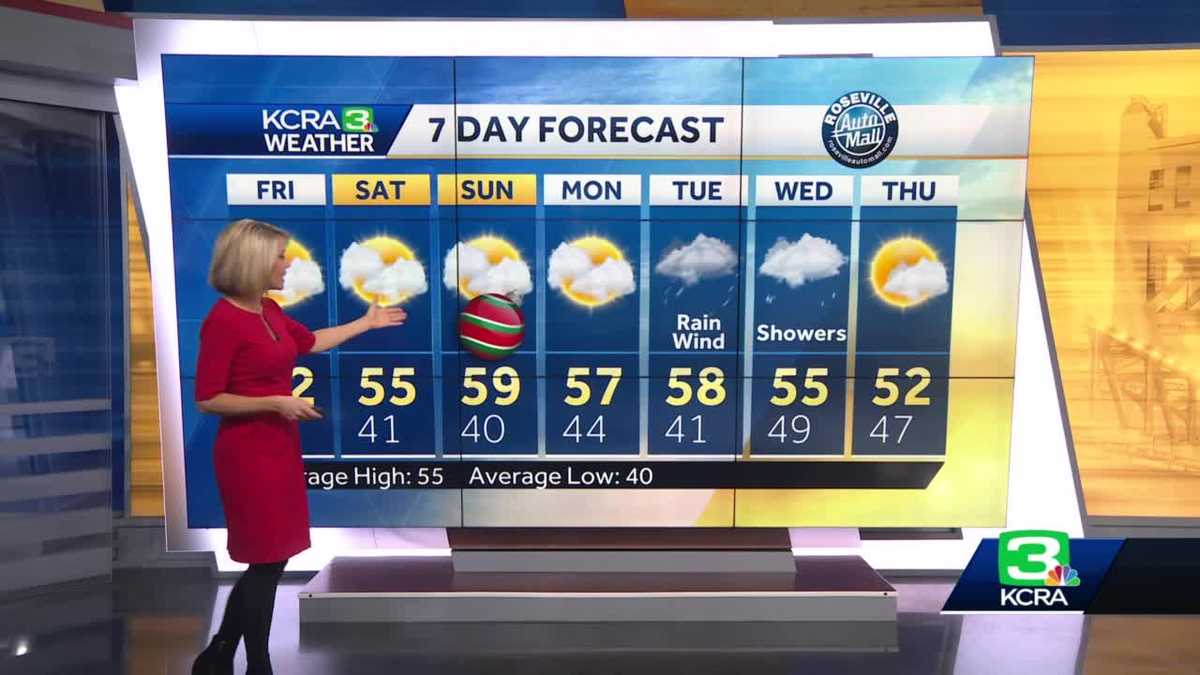
A ridge of high pressure will build over our holiday weekend with warming temperatures, especially for the Foothills and Sierra.
Expect scattered clouds with high temperatures ranging in the 60s in the Foothills on Christmas Day. Lake Tahoe wants to see highs in the 50s.
As for the Valley, the wild card is the fog. The potential is there to warm to near 60 if morning fog mixes out. However, if it lingers, highs will only range in the 40s to near 50.
Expect Northern California rain and snow next week
Our next big weather maker is in sight for Tuesday.
Expect gusty southerly winds Tuesday as well as the potential for heavy rain. At this point, the Valley will likely see more than an inch of rain, perhaps even near 2 inches in some spots.
Since this is a warmer system, the Sierra will likely see high snow levels starting at 8,000 feet or higher elevations.
The snow may drop to pass level by late Tuesday. Stay tuned for more details as we get closer.
Download our app for the latest
Here is where you can download our app for the latest weather alerts.
Follow our KCRA weather team on social media
Watch our forecasts on TV or online
Here’s where to find our latest video forecast. You can also watch a live stream of our latest newscast here. The banner on our website turns red when we’re live.
We’re also streaming on the Very Local app for Roku, Apple TV or Amazon Fire TV.
Track Northern California Doppler radar here
(App users, click here to see our interactive radar map.)
Traveling this weekend? Track real-time traffic updates here
(App users, click here to see our interactive traffic map.)