
Wet winter storm moving across Northern California
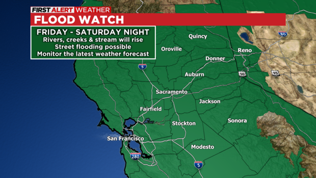
A series of Pacific storms are expected to slam into northern California and the concern for flooding is rising. Flood Watches are in effect through late Saturday night due to excessive rain and melting snow.
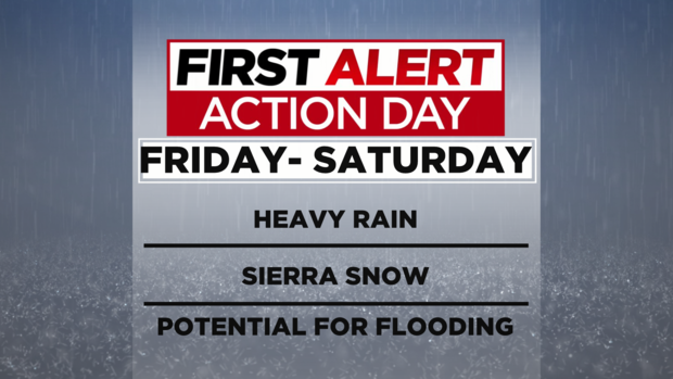
We have opted to go with a First Alert Action Day for Friday and Saturday due to the widespread impacts associated with the upcoming storm.
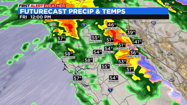
Snow levels will rise through the day Friday, allowing snow to change over to rain in the higher elevations. These snow levels are expected to rise up to 8,500 feet on Friday before falling back down to 4,500-6,000 feet by Saturday evening.
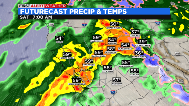
Areas like Donner Pass are expected to switch over to rain by noon Friday with moderate to heavy rain falling over the Foothills and the Sierra. The Valley will experience showers with the steady rain likely holding off until Friday night.
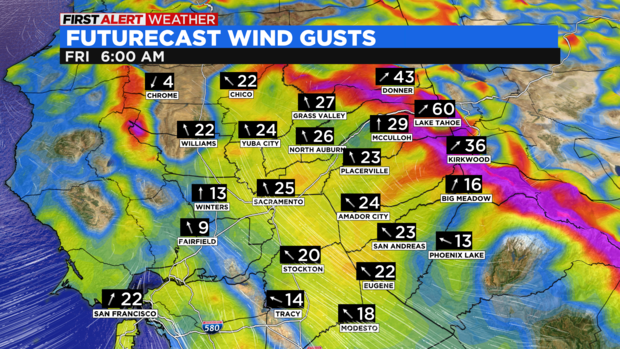
Winds will ramp up in the Sierra on Friday with gusts approaching 45-60 miles per hour. The winds will be much stronger along the ridges where gusts may exceed 100 mph. Localized power outages will be possible in the Sierra Friday due to the strong winds.
Rain will pick up Friday night with moderate to heavy rain falling across the Valley by Saturday morning. This band of rain will pose the greatest threat to street flooding in the valley. Rivers and streams will likely experience a sharp rise in water levels but most of the area rivers will likely remain below flood stage. Nonetheless, it is very important to monitor the latest trends with the forecast should rivers rise further. If you live in a flood zone, have an evacuation plan. While this scenario is unlikely, we encourage you to be prepared just in case evacuations are necessary.
We will monitor the potential for flash flooding over the burn scar areas too, especially if very heavy rain develops over those locations sensitive to heavy rain.
Snow levels will start falling through the day Saturday. Expect road closures and chain laws to be in place for the passes as roads will become snow-covered and visibility will be greatly reduced.
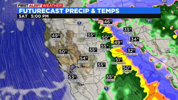
Happily, anyone planning New Year’s Eve events in the Valley will likely be drying out by the time the ball drops. Showers will linger in the Sierra Sunday morning too.
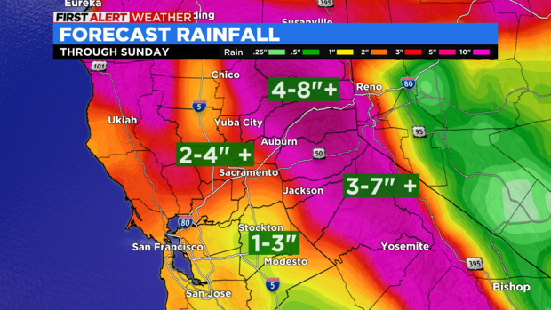
By the time the event is over, the Valley would have received 2-4 inches of rain with slightly fewer amounts possible further south. Significant rainfall amounts are expected in the Foothills and Sierra, totaling 3-7 inches, with locally higher amounts.
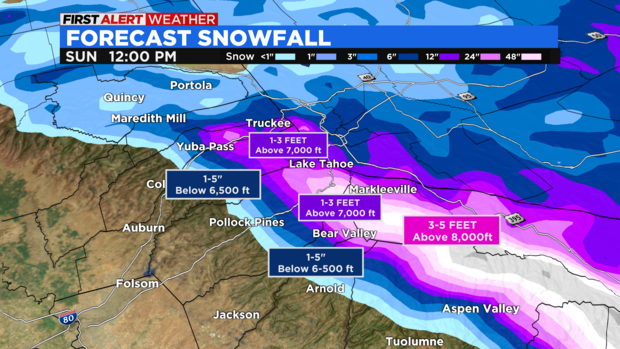
Snowfall amounts will add up significantly above 7,000 ft where 1-3 feet of snow is possible. Snowfall amounts drop off quickly below 7,000 ft with only a few inches expected below the 6,500 ft elevation mark.
An active pattern will continue into next week with another storm moving in next Monday, followed by a more significant storm next Wednesday.
One thing is for certain, if the atmospheric river pattern continues to bring a continuous stretch of soaking storms, the risk of flooding will increase quickly. We encourage you to monitor the latest forecast and trends as we head into the upcoming week.