
Storm starts to hit Northern California, tens of thousands without power
CBS13’s Chief Meteorologist Nic Merianos breaks down the latest forecast on the coming storm:
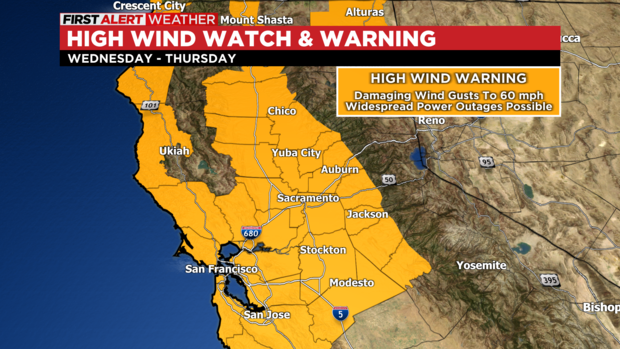
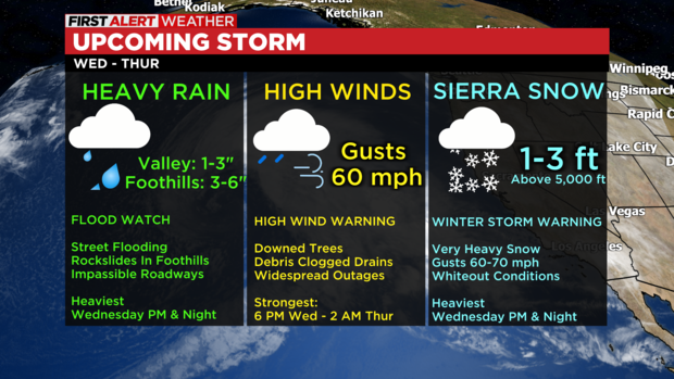
WEATHER ALERTS:
High Wind Warning: Valley & Foothills
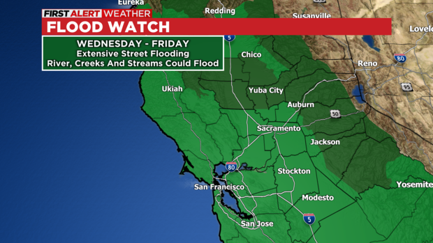
FloodWatch – Valley & Foothills
Flash Flood Watch: Foothills (Burn Scar Areas)
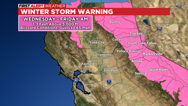
Winter Storm Warning– Sierra
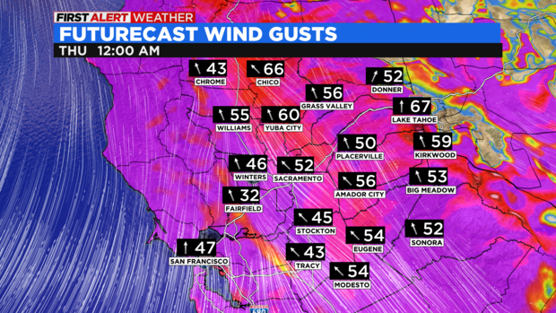
STRONG TO DAMAGING WINDS:
Southerly winds will increase Wednesday afternoon bringing a period of strong to damaging wind gusts. The Valley and Foothills may experience wind gusts approaching 50-60 mph. The combination of high winds and wet grounds will have the potential to bring down or uproot numerous trees. This will result in the potential for widespread and prolonged outages. The core of the damaging winds will likely arrive between 5pm and 2am.
Debris, such as branches, may clog storm drains or dam rivers. This would exacerbate any flooding in areas where this occurs.
Charge up your electronics and ensure your flashlights are in working order.
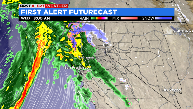
HEAVY RAIN:
Rain will move into our area, becoming heavy at times Wednesday morning. Urban flooding and street flooding may develop rapidly, especially with already saturated soils. The first batch of rain will lift to the northeast with parts of the Valley getting a midday break. Another batch of very heavy rain will swing through later in the day and continue into the overnight. The second batch of rain will pose the greatest threat for renewed flooding.
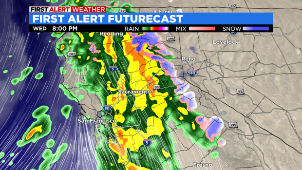
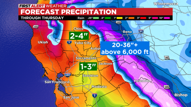
The rain will taper off Thursday morning with off and on showers through the rest of the day. Rainfall totals will likely range from 1-3 inches in the Valley to 2-5 inches in the Foothills. Isolated amounts of rainfall of 4 inches in the Sacramento Valley and 6 inches in the Sierra Foothills.
People in the Valley can expect extensive street flooding with roads becoming impassible at times, especially in flood prone areas. Heavy rain in the Foothills may result in additional rockslides and flooding along rivers, creeks and streams. Roads may become impassible in flooded areas.
The Cosumnes and Mokelumne Rivers will both be ones to watch, especially where breaches/ breaks have occurred. Many small creeks and streams may approach flood stage. This must be monitored as a few may reach minor or moderate flooding.
HEAVY SNOW:
Snow in the Sierra will become heavy Wednesday morning with snow levels as low as 4,000 ft. Snow levels will quickly rise to 7,000 ft Wednesday afternoon before falling back to 4,500 ft Thursday morning. Travel will be very difficult with whiteout conditions, chain controls and expected road closures.
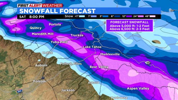
Snowfall will range from 1-2 feet above 5,000 ft to 2-3 feet above 6,500 ft. Snow will taper off on Thursday.
SUMMARY:
Widespread impacts are expected Wednesday and Thursday across our entire region. We don’t anticipate widespread river flooding, although there will be some along the smaller creeks and streams. However, the combination of saturated grounds and potentially clogged drains from debris will result in significant street flooding. The Cosumnes and Mokelumne should be monitored closely.
Localized impacts associated with runoff and poor drainage may linger into Friday. Much of Friday will be quiet weather-wise from additional rain. Most rivers will likely crest near or below flood stage Thursday with larger rivers cresting sometime on Friday.
Another atmospheric river event will impact our area late Saturday into Sunday. This will renew the potential for additional flooding across our area. Please continue to monitor the forecast for the latest information in the days ahead.