Evacuations, shelter-in-place orders as New Year’s storm pummels Sacramento and Northern California
By CapRadio staff
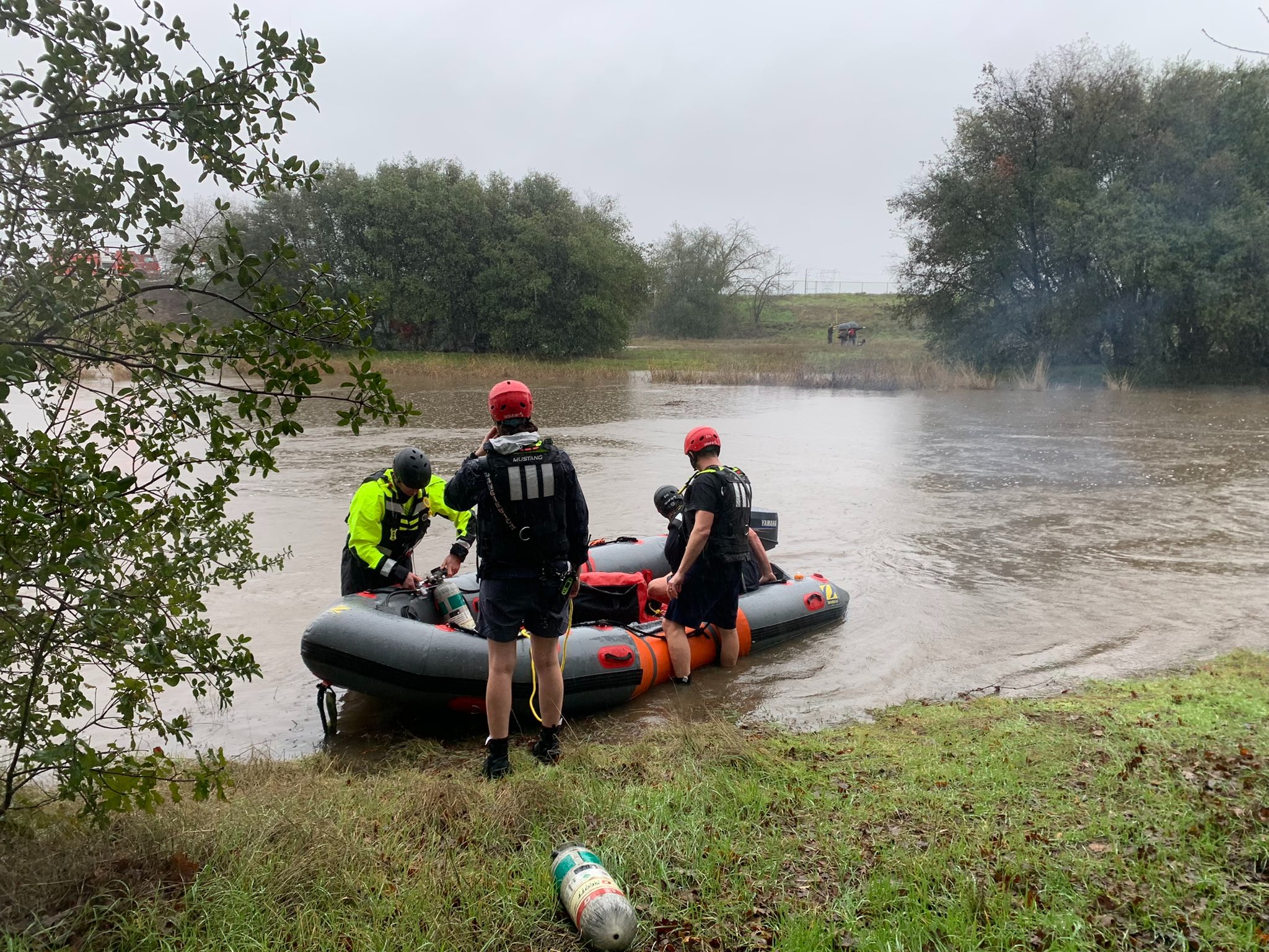
Evacuation warnings and shelter-in-place orders are happening across Sacramento County and nearby communities on Saturday as a major New Year’s storm continues to pummel Northern California.
The town of Wilton — approximately a half-hour from downtown Sacramento — is under an emandatory shelter-in-place order due to rising waters making roads impassable.
.@SacramentoOES is ordering residents living in Wilton to shelter in place. Rising water has made area roads impassable. Residents currently on Dillard Road should continue to safety toward the Wackford Center. Those who are at home should stay there.https://t.co/rI7jurBcKo pic.twitter.com/H8ZcxQt7zO
— Sacramento County (@SacCountyCA) December 31, 2022
In nearby El Dorado County, some residents of Cameron Park were forced to evacuate due to flooding, as well.
Communities in the Sacramento metro area have experienced anywhere from one to nearly 5 inches of rain in the past 24 hours.
Sacramento’s National Weather Service is warning of possible flooding over the next day in multiple communities, as well.
Along with urban flooding, multiple mainstem rivers are flooding or could flood by tomorrow afternoon. If you live near one of the rivers forecast to reach Flood Stage, keep an eye on the forecast & have a plan in place in case flooding affects you. https://t.co/PnYbuANEkQ #CAwx pic.twitter.com/ZhgFcIVP54
— NWS Sacramento (@NWSSacramento) December 31, 2022
The New Year’s weekend storm has brought unexpected levels of rain as a winter storm lingered over the Sacramento Valley and San Francisco Bay Area.
The Cosumnes River, which spans the southeastern reaches of Sacramento County, is forecast to see its highest water levels in 25 years.
In the mountains, Interstate 80 has experienced traffic delays and Highway 50 temporarily closed on Saturday due to flooding.
UPDATE: EB 50 traffic is back OPEN in Pollock Pines but HOLDING all traffic over Echo Summit for avalanche control. 80 traffic is being turned around EB in Colfax and WB at the state line. No ETO. pic.twitter.com/64Sy1j5eoR
— Caltrans District 3 (@CaltransDist3) December 31, 2022
Saturday’s storm is expected to pass by the evening. But meteorologists and climate experts remain concerned that storms in the coming week will bring additional inches of rain and prompt more flooding.
This story will be updated with new information as it is available.
Follow us for more stories like this
CapRadio provides a trusted source of news because of you. As a nonprofit organization, donations from people like you sustain the journalism that allows us to discover stories that are important to our audience. If you believe in what we do and support our mission, please donate today.
DonateToday