Northern California prepares for Wednesday rain, damaging winds
Northern California is preparing for another strong weather system to arrive on Wednesday that is expected to bring dangerous winds that down more trees and knock out power in the greater Sacramento area. Gov. Gavin Newsom has declared a state of emergency in advance of the storm, Cal OES Director Nancy Ward announced. | MORE | Northern California forecast: Rain, widespread high winds, preparing for possible power outagesCalifornia emergency officials are giving an update at 11 a.m. on the storm response. Watch in video player above. Find the latest forecast and storm updates from across the region below:KCRA 3 is calling Wednesday an Alert Day due to the strong winds, where gusts are expected between 40 to 50 mph.The latest severe weather arrives as the region continues to deal with the aftermath of the New Year’s Eve storm that brought heavy rain and strong winds. The weekend storm caused widespread flooding across Northern California, knocked out power for thousands and stranded dozens on flooded roadways. One person was found dead inside a submerged vehicle near Dillard Road, as first responders continue to search for at least one missing person. Residents of Point Pleasant, Glanville Tract and Franklin Pond were ordered to evacuate due to flooding on Sunday. Evacuation orders remain in place.In Sacramento, more than 1,000 remained without power on Tuesday night.A spokesperson with SMUD told KCRA 3 on Monday that the utility will remain in an all-hands-on-deck position for Wednesday’s storm. The utility warned that this next storm is expected to “be worse” with “multiple hours of high winds and gusts exceeding 50mph.””The ground is now saturated from multiple days of heavy rains and more downed trees and poles are likely,” SMUD said.| MORE | Find SMUD’s outage map hereThe weekend storm also caused the Cosumnes River to reach its highest level in history and brought flooding to Wilton and parts of south Sacramento County. The county later confirmed Sunday that there had been a double levee breach. County officials have issued a local state of emergency and said they will be collecting damage estimates. Spokesperson Kim Nava said the proclamation will give the county’s director of emergency services the authority to fully use all county resources and personnel to assist with the emergency.They could later seek reimbursement if a state or federal emergency proclamation is issued.LATEST FORECASTRain and widespread high winds coming to Northern California on Wednesday are prompting the KCRA 3 weather team to call for a Weather Alert Day. This will likely be the most impactful part of this midweek storm. The ground is already saturated, meaning tree roots may not have as much support when wind comes through. This could lead to substantial tree and power line damage and outages. Gusts are expected to reach 40 to 50 mph Wednesday evening but all of Wednesday will be breezy.Meteorologist Dirk Verdoorn says that although rain is a concern Wednesday, Northern California won’t get as much rain as we received in the system over the weekend. Winds are expected to be more of a concern Wednesday. “The wind is also going to be a big variable. That is the big reason why today is an alert day because of the potential for damaging winds which could be racing across the area, especially later on today,” meteorologist Tamara Berg said. By 9 a.m., wind speeds in the area coping up out of the south will be in the 15 mph to 20 mph range. Closer to 5 p.m., winds will have more of a widespread impact and pickup to 20 mph to 30 mph.By 10 p.m., winds will get even stronger, with gusts in the 40 mph to 50 mph range. HERE ARE THE LATEST UPDATES:Wednesday Updates:11:09 a.m.: Gov. Gavin Newsom has declared a state of emergency in advance of the storm, Cal OES Director Nancy Ward just announced.Ward called for people to stay informed by signing up for county emergency alerts and to check on family members and neighbors.”Always follow the direction of local authorities,” she said. “If you are told to evacuate, please do so.” 10:49 a.m.: Capt. Keith Wade with the Sacramento Fire Department joined KCRA 3 on Wednesday morning to explain the difference between when people should call 311 versus 911. Downed trees in a roadway or flooding on roads is a 311 call, he said. It shouldn’t be a 911 call unless the tree has crashed into a home or there is a downed powerline. Wade also urged people not to drive through water that is rushing across streets. It only takes a foot of water to render a sedan incapable, he said. “Use some common sense today,” he said.7:42 a.m.: NWS Sacramento encourages those who must travel to do so before dark.7:22 a.m.: SMUD advises that if a storm knocks down a power line, assume it is energized and call SMUD or 911 immediately. 6:37 a.m.: The National Weather Service in Reno says that snow levels will be rising later today and then falling again overnight. Tuesday Updates:11:12 p.m.: The city of Sacramento is asking people to call 311 if they see street flooding, traffic lights that aren’t working, or downed trees, KCRA 3’s Melanie Wingo reports. 10:20 p.m.: PG&E and SMUD both expect more power outages tomorrow and are sharing storm safety tips. They include: Never touch downed wiresUse generators safely. PG&E recommends they are installed by a licensed electrician and in a well-ventilated area.Use flashlights, not candlesHave a backup phoneHave fresh drinking water and iceTurn off appliancesPrepare an emergency kit, including a portable cell phone charger, flashlight, fresh drinking water, extra batteries, a manual can opener and a battery-operated radio.| Video below | PG&E addresses customers’ long waits for power restoration in San Joaquin County8:51 p.m.: KCRA 3’s Josie Heart spoke to a family that faced days stuck inside their home in Galt after a tree knocked down a power pole next to their property. KCRA 3’s Michelle Bandur spoke to neighbors in Sacramento’s Swanston Estates neighborhood where a massive pine tree fell but avoided powerlines. 7:42 p.m.: Here’s an update from the Sacramento Fire Department. 7:16 p.m.: SMUD says it has restored power to more than 99% of customers whose lights went out in the New Year’s Eve storm. The storm caused more than 120 poles to be blown down and uprooted at least 115 trees. SMUD also warned that Wednesday’s storm is expected to “be worse” with “multiple hours of high winds and gusts exceeding 50mph.” “The ground is now saturated from multiple days of heavy rains and more downed trees and poles are likely,” SMUD said. 5:26 p.m.: San Joaquin County says it will close all regional, community and neighborhood parks on Wednesday in advance of the storm. The closure could last through Thursday or potentially, Friday, too. The county said the Micke Grove Zoo and Micke Grove Regional Park had “significant flooding and wind damage” and will remain closed through Sunday. 5:13 p.m.: There are still more than 1,000 SMUD customers without power. 5:04 p.m.: The National Weather Service says mountain travel is “highly discouraged” tomorrow.4:55 p.m.: KCRA 3’s Melanie Wingo reports that so far the city of Sacramento has received 200 calls about downed trees or limbs. The city expects to continue to be busy through this week with reports into 311.4:16 p.m.: Stockton Unified School District says families should “use caution and allow extra time while traveling to school” on Wednesday. 4:14 p.m.: Sacramento County is also closing all parks due to tree hazards. Read more. 1:01 p.m.: All parks in Stockton are closed due to tree hazards from the weekend storm and forecast high winds Wednesday.12:42 p.m.: Chain controls have been lifted on I-80 over Donner Summit, but CHP is warning of the upcoming system.7:08 a.m.: Chain controls are in place in the Sierra, according to CHP TruckeeDownload our app for the latestHere is where you can download our app for the latest weather alerts.Follow our KCRA weather team on social mediaChief Meteorologist Mark Finan on Facebook and TwitterMeteorologist Tamara Berg on Facebook and TwitterMeteorologist Eileen Javora on FacebookMeteorologist Dirk Verdoorn on FacebookMeteorologist/Climate Reporter Heather Waldman on Facebook and TwitterWatch our forecasts on TV or onlineHere’s where to find our latest video forecast. You can also watch a livestream of our latest newscast here. The banner on our website turns red when we’re live.We’re also streaming on the Very Local app for Roku, Apple TV or Amazon Fire TV.Track Northern California Doppler radar here(App users, click here to see our interactive radar map.)Track real-time traffic updates here(App users, click here to see our interactive traffic map.)
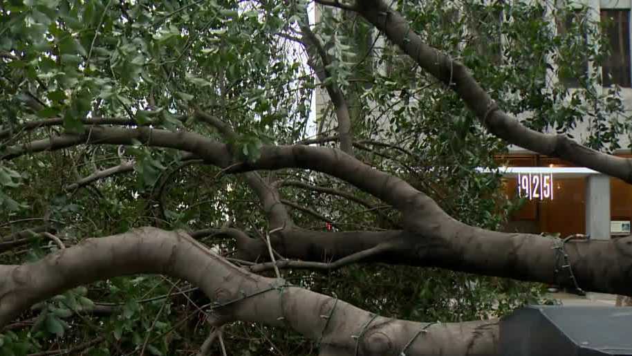
Northern California is preparing for another strong weather system to arrive on Wednesday that is expected to bring dangerous winds that down more trees and knock out power in the greater Sacramento area.
Gov. Gavin Newsom has declared a state of emergency in advance of the storm, Cal OES Director Nancy Ward announced.
| MORE | Northern California forecast: Rain, widespread high winds, preparing for possible power outages
California emergency officials are giving an update at 11 a.m. on the storm response. Watch in video player above.
Find the latest forecast and storm updates from across the region below:
KCRA 3 is calling Wednesday an Alert Day due to the strong winds, where gusts are expected between 40 to 50 mph.
The latest severe weather arrives as the region continues to deal with the aftermath of the New Year’s Eve storm that brought heavy rain and strong winds.
The weekend storm caused widespread flooding across Northern California, knocked out power for thousands and stranded dozens on flooded roadways.
One person was found dead inside a submerged vehicle near Dillard Road, as first responders continue to search for at least one missing person.
Residents of Point Pleasant, Glanville Tract and Franklin Pond were ordered to evacuate due to flooding on Sunday. Evacuation orders remain in place.
This content is imported from Twitter.
You may be able to find the same content in another format, or you may be able to find more information, at their web site.
Point Pleasant is now under an evacuation order. Get out before sunset so you aren’t trying to drive in the dark. Stay safe! https://t.co/SkWsCjojXs
— Sacramento County (@SacCountyCA) January 1, 2023
In Sacramento, more than 1,000 remained without power on Tuesday night.
A spokesperson with SMUD told KCRA 3 on Monday that the utility will remain in an all-hands-on-deck position for Wednesday’s storm.
The utility warned that this next storm is expected to “be worse” with “multiple hours of high winds and gusts exceeding 50mph.”
“The ground is now saturated from multiple days of heavy rains and more downed trees and poles are likely,” SMUD said.
| MORE | Find SMUD’s outage map here
The weekend storm also caused the Cosumnes River to reach its highest level in history and brought flooding to Wilton and parts of south Sacramento County. The county later confirmed Sunday that there had been a double levee breach.
County officials have issued a local state of emergency and said they will be collecting damage estimates. Spokesperson Kim Nava said the proclamation will give the county’s director of emergency services the authority to fully use all county resources and personnel to assist with the emergency.
They could later seek reimbursement if a state or federal emergency proclamation is issued.
LATEST FORECAST
Rain and widespread high winds coming to Northern California on Wednesday are prompting the KCRA 3 weather team to call for a Weather Alert Day.
This will likely be the most impactful part of this midweek storm. The ground is already saturated, meaning tree roots may not have as much support when wind comes through. This could lead to substantial tree and power line damage and outages. Gusts are expected to reach 40 to 50 mph Wednesday evening but all of Wednesday will be breezy.
Meteorologist Dirk Verdoorn says that although rain is a concern Wednesday, Northern California won’t get as much rain as we received in the system over the weekend.
Winds are expected to be more of a concern Wednesday.
“The wind is also going to be a big variable. That is the big reason why today is an alert day because of the potential for damaging winds which could be racing across the area, especially later on today,” meteorologist Tamara Berg said.
By 9 a.m., wind speeds in the area coping up out of the south will be in the 15 mph to 20 mph range.
Closer to 5 p.m., winds will have more of a widespread impact and pickup to 20 mph to 30 mph.
By 10 p.m., winds will get even stronger, with gusts in the 40 mph to 50 mph range.
HERE ARE THE LATEST UPDATES:
Wednesday Updates:
11:09 a.m.: Gov. Gavin Newsom has declared a state of emergency in advance of the storm, Cal OES Director Nancy Ward just announced.
Ward called for people to stay informed by signing up for county emergency alerts and to check on family members and neighbors.
“Always follow the direction of local authorities,” she said. “If you are told to evacuate, please do so.”
This content is imported from Twitter.
You may be able to find the same content in another format, or you may be able to find more information, at their web site.
The state operations center, where we are now, is now operating at its highest level, where agencies from across the state are gathered and monitoring conditions around the clock to coordinate resources and response.
Gov. Newsom himself is not here but was this morning.
— Ashley Zavala (@ZavalaA) January 4, 2023
10:49 a.m.: Capt. Keith Wade with the Sacramento Fire Department joined KCRA 3 on Wednesday morning to explain the difference between when people should call 311 versus 911.
Downed trees in a roadway or flooding on roads is a 311 call, he said. It shouldn’t be a 911 call unless the tree has crashed into a home or there is a downed powerline.
Wade also urged people not to drive through water that is rushing across streets.
It only takes a foot of water to render a sedan incapable, he said.
“Use some common sense today,” he said.
7:42 a.m.: NWS Sacramento encourages those who must travel to do so before dark.
This content is imported from Twitter.
You may be able to find the same content in another format, or you may be able to find more information, at their web site.
It’s here! Precip come in 2 waves today – this morning with a brief break in the afternoon. Then the real show begins this evening with heavy rainfall, mountain snow & VERY strong winds. If you have to travel today, it might be good to be to your destination before dark! #cawx pic.twitter.com/PiycR64Jlk
— NWS Sacramento (@NWSSacramento) January 4, 2023
7:22 a.m.: SMUD advises that if a storm knocks down a power line, assume it is energized and call SMUD or 911 immediately.
This content is imported from Twitter.
You may be able to find the same content in another format, or you may be able to find more information, at their web site.
Please be safe!
If stormy weather knocks down a power line:
📞 Stay away and call SMUD at 1-888-456-SMUD (7683) or 911 immediately.
⚡️ Assume the line is “energized” and stay away and warn others to do the same. pic.twitter.com/xbovv9cx1q
— SMUD (@SMUDUpdates) January 4, 2023
6:37 a.m.: The National Weather Service in Reno says that snow levels will be rising later today and then falling again overnight.
This content is imported from Twitter.
You may be able to find the same content in another format, or you may be able to find more information, at their web site.
Snow levels will be rising in the Sierra later this morning, and this afternoon in W NV, then falling again overnight.
— NWS Reno (@NWSReno) January 4, 2023
Tuesday Updates:
11:12 p.m.: The city of Sacramento is asking people to call 311 if they see street flooding, traffic lights that aren’t working, or downed trees, KCRA 3’s Melanie Wingo reports.
10:20 p.m.: PG&E and SMUD both expect more power outages tomorrow and are sharing storm safety tips. They include:
- Never touch downed wires
- Use generators safely. PG&E recommends they are installed by a licensed electrician and in a well-ventilated area.
- Use flashlights, not candles
- Have a backup phone
- Have fresh drinking water and ice
- Turn off appliances
- Prepare an emergency kit, including a portable cell phone charger, flashlight, fresh drinking water, extra batteries, a manual can opener and a battery-operated radio.
| Video below | PG&E addresses customers’ long waits for power restoration in San Joaquin County
8:51 p.m.: KCRA 3’s Josie Heart spoke to a family that faced days stuck inside their home in Galt after a tree knocked down a power pole next to their property.
KCRA 3’s Michelle Bandur spoke to neighbors in Sacramento’s Swanston Estates neighborhood where a massive pine tree fell but avoided powerlines.
7:42 p.m.: Here’s an update from the Sacramento Fire Department.
This content is imported from Twitter.
You may be able to find the same content in another format, or you may be able to find more information, at their web site.
Avoid driving during the storm if you can. People are urged to plan ahead and watch for debris and localized flooding on the roads. Never drive or walk through flood waters. Turn around, Don’t drown!
— Sacramento Fire Department (@SacFirePIO) January 4, 2023
7:16 p.m.: SMUD says it has restored power to more than 99% of customers whose lights went out in the New Year’s Eve storm. The storm caused more than 120 poles to be blown down and uprooted at least 115 trees.
SMUD also warned that Wednesday’s storm is expected to “be worse” with “multiple hours of high winds and gusts exceeding 50mph.”
“The ground is now saturated from multiple days of heavy rains and more downed trees and poles are likely,” SMUD said.
5:26 p.m.: San Joaquin County says it will close all regional, community and neighborhood parks on Wednesday in advance of the storm. The closure could last through Thursday or potentially, Friday, too.
The county said the Micke Grove Zoo and Micke Grove Regional Park had “significant flooding and wind damage” and will remain closed through Sunday.
5:13 p.m.: There are still more than 1,000 SMUD customers without power.
This content is imported from Twitter.
You may be able to find the same content in another format, or you may be able to find more information, at their web site.
5:04 p.m.: The National Weather Service says mountain travel is “highly discouraged” tomorrow.
This content is imported from Twitter.
You may be able to find the same content in another format, or you may be able to find more information, at their web site.
Heavy snow returns Wednesday – as a strong system moves through the area. Snowfall amounts up to 1-3 feet are possible. Expect chain controls, dangerous travel, strong winds and periods of whiteout conditions. Mountain travel is HIGHLY discouraged! #cawx pic.twitter.com/9aH8MJoA6d
— NWS Sacramento (@NWSSacramento) January 4, 2023
4:55 p.m.: KCRA 3’s Melanie Wingo reports that so far the city of Sacramento has received 200 calls about downed trees or limbs. The city expects to continue to be busy through this week with reports into 311.
4:16 p.m.: Stockton Unified School District says families should “use caution and allow extra time while traveling to school” on Wednesday.
4:14 p.m.: Sacramento County is also closing all parks due to tree hazards.
Read more.
1:01 p.m.: All parks in Stockton are closed due to tree hazards from the weekend storm and forecast high winds Wednesday.
This content is imported from Facebook.
You may be able to find the same content in another format, or you may be able to find more information, at their web site.
12:42 p.m.: Chain controls have been lifted on I-80 over Donner Summit, but CHP is warning of the upcoming system.
This content is imported from Twitter.
You may be able to find the same content in another format, or you may be able to find more information, at their web site.
Chain control has been lifted on I-80 over Donner Summit! But it’s not over yet as another system is coming in starting early tomorrow morning through Friday morning. Expect difficult to impossible travel with extensive delays… Be prepared and plan ahead! pic.twitter.com/oJyzAM6eNh
— CHP Truckee (@CHP_Truckee) January 3, 2023
7:08 a.m.: Chain controls are in place in the Sierra, according to CHP Truckee
This content is imported from Twitter.
You may be able to find the same content in another format, or you may be able to find more information, at their web site.
❄️ CHAIN CONTROL UPDATE ❄️
01/03/23 7:00am
• I-80 is R2 in both directions from the Nevada State line to Drum Forebay.
• SR-267 has no controls.
• SR-28 is R1 from Tahoe City to Kings Beach.
• SR-89 is R-1 from Truckee to Tahoe City. pic.twitter.com/X0L904Wq8Z
— CHP Truckee (@CHP_Truckee) January 3, 2023
Download our app for the latest
Here is where you can download our app for the latest weather alerts.
Follow our KCRA weather team on social media
Watch our forecasts on TV or online
Here’s where to find our latest video forecast. You can also watch a livestream of our latest newscast here. The banner on our website turns red when we’re live.
We’re also streaming on the Very Local app for Roku, Apple TV or Amazon Fire TV.
Track Northern California Doppler radar here
(App users, click here to see our interactive radar map.)
Track real-time traffic updates here
(App users, click here to see our interactive traffic map.)